Friday, April 30, 2010

N.I.T.: CaliforNapier

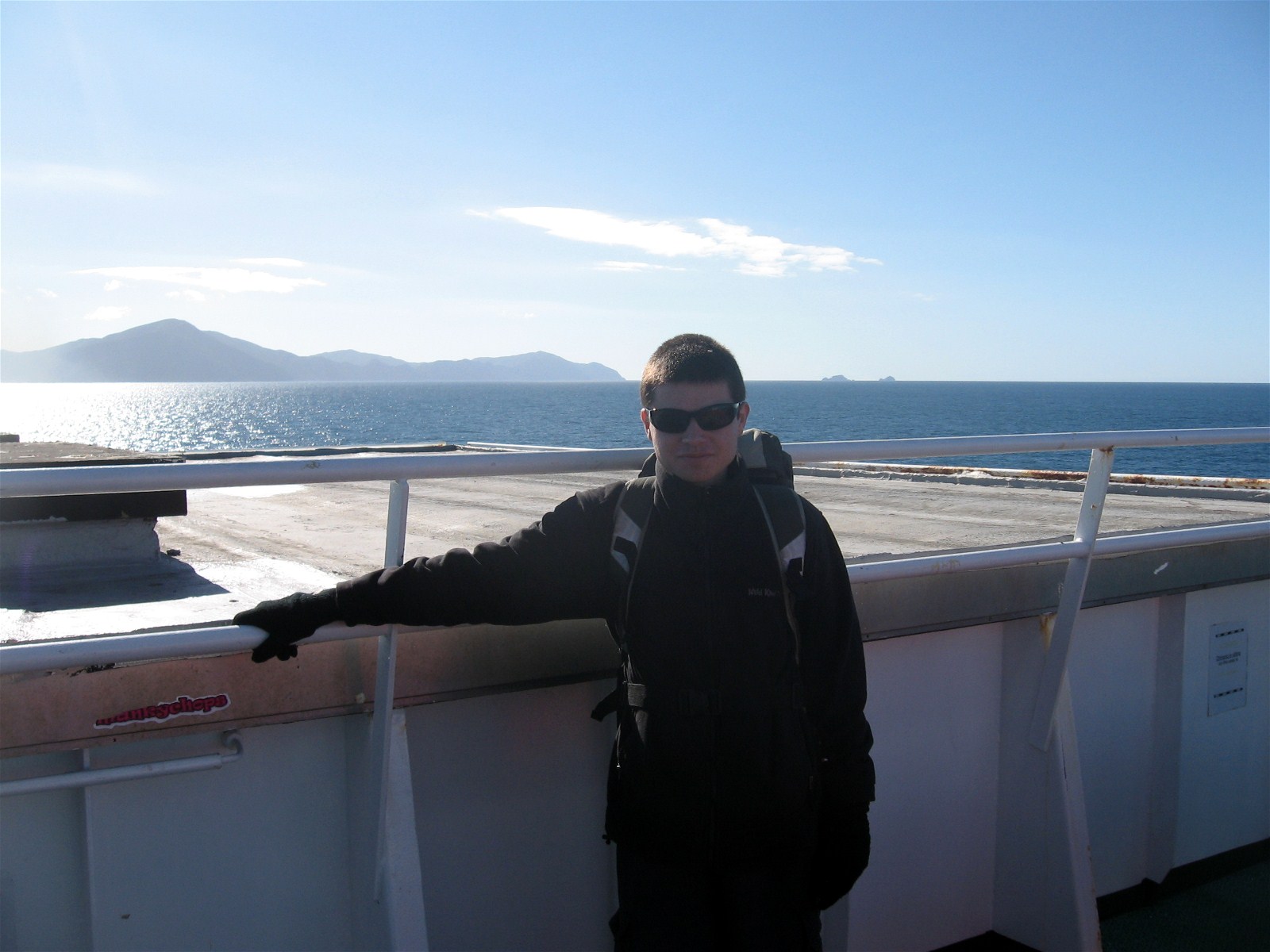
The skies were clear as our turboprop flew to Napier. My brother & I could see as far as Mount Taranaki, more than 200km away! Also known as Mount Egmont, Taranaki is 2518m (8,261ft) above sea level, and is the natural centrepiece of the Taranaki region, located on the west coast of the North Island. I personally call this region the North Island's Ear because of its appearance from satellite photos. Napier is a port city in Hawke's Bay with a population of 58,100. Just 20km south lies the town of Hastings City with a population of 64,500. These two centres are often called 'The Twin Cities'.

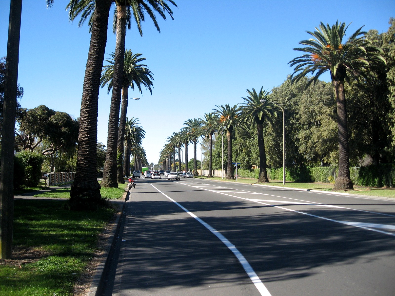
After 50 minutes, the plane landed safely in Napier and we disembarked onto the deserted tarmac. There are no baggage carousels at the Napier Terminal; instead your luggage is brought into a small garage by the airport crews & then you take them off the carts. The taxi ride into town was uneventful but my brother & I got to see a brief layout of certain streets. One thing that was clearly noticeable to me were the palm trees, conjuring up images of Los Angeles in my mind. The taxi dropped us off at the 4-star YHA hostel, and we checked into our twin room with ease. The hostel occupies a white cottage like house (that could use some inside/outside renovation) on Marine Parade Road along the rocky beach coastline. Marine Parade resembles Ocean Drive in Miami Beach except the street is lined with tall pine trees rather than palm trees.

Our stay in Napier would feel like 3 full days because we had arrived in the early morning & were checked in by 1030. With days to spare, I decided to walk around the area to see what the town has to offer. Along Marine Parade Road are restaurants, mini golf, skateboard park, children's park, Marine Land, and The National Aquarium of NZ. I should note that Marine Land has been closed since September 11th, 2008 because that's when Kelly, the last remaining dolphin, passed away.


Emerson Street is a road/street mall that runs through the centre of Napier. It's similar to the Sparks Street Mall in my hometown of Ottawa, Canada, except there're more shops than restaurants. On a positive note, there are cafes to for the hungry, but they're mostly situated next to Civic Square. Napier's 1930s Art Deco architecture has made it a popular tourist destination & has earned it the title of Art Deco Capital of the World. This style of architecture was introduced after the deadly earthquake on February 3rd, 1931. With the town centre & surrounding area destroyed, it was decided that the town would be rebuilt in the newest style at the time, the Art Deco style. The Art Deco Trust was established in 1985 to promote the city & maintain all the Art Deco buildings through donations. The Trust is located in the old fire station near Civic Square & offers guided walking/driving tours.


I proceeded to explore Napier South, getting a closer look to large cricket stadium we passed by during the taxi ride into town. The stadium is called McLean Park & was built in 1952. It's seating capacity is 22,000. Also nearby is the oval shaped Nelson Park. The park is basically a large green field surrounded by palm trees, and used to play community rugby & cricket. Kennedy Road is a main street that is lined with tall palm trees, occupying several parking spaces. Walking down this street with the clear blue sky above makes you think that you're in Los Angeles, California, but the left hand vehicle traffic reminds you where you're really are.

The afternoon sun forced me to retreat back to the hostel because I wasn't wearing a hat. Luckily, before my head really started to hurt, I bought some sunscreen at Pak n Save. The first day in Napier had gone by quite well. For the next day I would explore the Aquarium & the port.
To Be Continued . . .
(Post 7 of 10)

Monday, April 26, 2010

Term 2 Begins & ANZAC Day

(I hadn't originally planned to interrupt my North Island Tour series but circumstances have made it inevitable. I had hoped to have the series finished last week but I needed to focus & work on my teaching practice. For this post, I'll be focusing on what happened last week & this past weekend.)

Last week was the first week of Term 2 & students had come back to Riccarton High with plenty of stories about their two week break. However, a group of students who had gone to France for a school trip were unable to return because of the eruption of Mount Eyjafjallajökull in Iceland. Yeah, try pronouncing that word correctly; I've given up & so have most media outlets. I'm still surprised that the ash cloud from one volcano can cause so much havoc on air travel. Thousands of flights have been cancelled and/or delayed in Europe forcing many travellers to wait for days & weeks. For our students (two of which are in my class), they wouldn't arrive safely home until the following week.

From the first day back, it was business as usual, and I continued teaching my Year 13s about the Baroque Era. We spent the week learning about Concerto Grosso / Ritornello Form, and the creation Opera. For Concerto Grosso, I had them listen & analyse the 1st Movement of Bach's Brandenburg Concerto No. 5 in D Major, whereas for the opera lesson, they watched a DVD & had questions to answer. They worked hard & were attentive because I had announced that there would be a final quiz on the topic the following week.

For my Year 12s, I introduced their next unit, musical composition. I didn't get the opportunity to teach them last term because my associate needed the time to complete the previous unit. The first lesson was a little slow because I wanted to get the boring explanations out of the way before they started writing. After explaining the 4 elements of music (Melody, Harmony, Rhythm, Dynamics), I had them writing their own melodies with the help of electronic keyboards during the second lesson. Despite their objections, I had them present their melodies to the class. At least I didn't make them sing; that would have been cruel.

There were only Jazz Band & Ukulele Band practices last week because not enough students showed up for orchestra practice on Friday. The jazz band is getting ready to perform at the library in the middle of May, presenting songs such as 'Car Wash', 'Crazy Little Thing Called Love', and maybe 'Stairway To Heaven'. The ukulele band practiced a classic NZ song by Split Enz titled 'Six Months On A Leaky Boat'. The song got me thinking: didn't anyone think to pull into a port to get the boat repaired during those six months?

As always, I stayed after school on Friday to enjoy the party in the teacher's lounge. The theme for the week was summer, & some of the teacher were wearing flower dresses. Along with the alcohol, the food up for grabs were fruit, biscuits (crackers), and ice cream. The parties also give teachers the chance to talk to others about the week that just passed, and I chatted with several teachers about our adventures.

This past Sunday (April 25th) was ANZAC Day, similar to Canada's Remembrance Day, where Australians & New Zealanders commemorate the members of the Australian & New Zealand Army Corps (ANZAC) who fought at Gallipoli, Turkey during WWI. The commemoration now includes all those who died & served in military operations overseas. I decided to tag along with the army cadet corps I volunteer with to the ceremonies at Burnham Military Camp and another at Papanui Returned And Services' Association (RSA).

To attend the Burnham ceremony, I had to wake up & get dressed at 0400, and get picked up by a friend at 0450 so that we would be at the camp by 0515. The poppies here are bigger & slightly different than their North American counterparts. People had already started to arrive before we pulled up to the base. By the time the ceremony began at 0600, a big crowd had assembled around the main gates of the camp. The Dawn Ceremony draws its link to the Dawn Landings on Gallipoli back in April 1915. The ceremony is an hour long & the program is extensive, so I'll say that it's similar to a Canadian Remembrance Day Ceremony, with the laying of wreaths, guest speakers, national anthem, prayers, and one minute of silence.

I should also say that the loudest parts of the ceremony are the Minute Warning & Firing of Volleys. The Minute Warning happens at 0629 and is marked by the firing of a 5 inch artillery gun and trust me, you hear it. Everyone is tense before the loud BOOM! because the gun is fired unannounced & its location is close. The Firing of Volleys is done by a small Honour Guard who fire 3 shots from Steyr assault rifles. They're not as loud as the artillery piece but it still made me jump.

After the ceremony, guests were welcomed to eat breakfast at the main mess hall for $5. Because I was with the cadet corps, I got to eat for free because the corps was paying. There were poached eggs, scrambled eggs, beans, sausages, hash browns, bacon, pancakes, bread, and various spreads. I mostly ate the hash browns and bacon.

On our way to the Papanui ceremony, news had broken that an NZ Air Force Iroquois helicopter had crashed 40 km north of Wellington in rugged terrain near Pukerua Bay, killing 3 & seriously wounding one. The helicopter was to take part in a fly by during an ANZAC ceremony in Wellington. Because the aircraft didn't carry a black box, investigators will have to reconstruct events using the debris from the crash site & eye witness accounts which could take months.

At Papanui, there was a short parade through the streets, before the ceremony began at the 1000. The program was similar to the one in Burnham minus the loud guns. The girls choir from Riccarton High School (where I teach) took part in the ceremony by singing the NZ & French National Anthems, God Save The Queen, and God of Nations. After the ceremony, guests were welcomed to a reception in the RSA building where they served sandwiches and sold alcohol at the bar.
Upon returning home, I changed into less formal clothing & got to work, planning lessons for the following week.

Sunday, April 25, 2010

N.I.T.: Planes, Pains, & Automobiles

The Lamborghini Gallardo was gone the next morning when I emerged from the hostel. For the second day, I decided to explore the eastern part of town, located on the other side of Mt. Victoria. Rather than scale the tall hill, I chose to walk through it via the Mount Victoria Tunnel. The tunnel is 623 metres long, two lanes wide, and opened in 1931, connecting the Hataitai suburb to the city centre. While traversing the narrow walkway, the passing cars began to honk periodically & frequently. Since this was happening in a tunnel, the resulting noises were very loud. I originally thought the drivers were honking because an NZ sports team had won a match but after doing some research several days later I learned that that wasn't the case. Drivers engage in a 'Beeping Game', a local tradition that has existed since WW2, but traces back to when the tunnel opened. Back then, the tunnel was mostly used by pedestrians. The few cars that did drive through had to beep at the pedestrians to get out of the way. Next time, I'll be wearing earplugs.


Once out of the loud tunnel, I walked through the quiet section of the Hataitai suburb near Evans Bay. The layout of the area reminded me of the quiet residential streets with bungalows that I observed back in Nelson. The suburban villas of Wellington are built in the style of 19th century architecture, a characteristic that I find tough to enjoy because I prefer modern/contemporary. Building such a residence in this area would be impossible because it would stick out like an eyesore. If I ever decide to live in Wellington, I will have to build my modern house in another area. There was a lot of sports activity happening at Kilbirnie Park when I walked past it. The green fields were being used for football (soccer) & rugby matches. My guess is that the matches were college related because St. Patrick's College sits just across the street from the park. Then again, I could be wrong and it was a community tournament.


A section of State Highway 1 leading to the airport, called Cobham Drive, is the location of numerous artistic sculptures focusing on the wind. The two most appealing to me are the Zephyrometer and The Urban Forest. The Zephyrometer is a tall orange needle that according to the official description, "embraces a number of marine-type associations [such as] masts, dials, & speedometers . . ." The sculpture was designed by Phil Price in 2003. The Urban Forest is a 2007 sculpture collaboration between Leon van den Eijkel & Allan Brown. The multi-coloured boxes are stacked on three concrete blocks and gradually rotate with the help of the wind.

The Wellington International Airport is situated on a small plateau, similar to the Whitehorse International Airport in northern Canada. Surprisingly, the control tower sits on a small hill surrounded by houses. Planes land & take off over Evans and Lyall Bays. The flight paths cross over main roads enabling you to view arriving & departing planes with ease. In the late afternoon, I walked up a small hill next to one end of the runway and watched airport activity for some time. If I had a hat or umbrella to block the sun, I could have watched planes all day. In between my plane watching, I briefly explored the Miramar neighbourhood. I found a small chip shop to have a light snack. While I ate my chips (french fries), a lone pigeon walked around the store eating crumbs off the floor before being chased away by the shop owner.


As the sun began to set, I walked back towards the hostel but this time traversed over Mount Victoria via Constable Street. I then proceeded north through the shopping/commercial district of Wellington South and into the city centre. Since my brother & I had to wake up early the next morning, we opted for a fast food dinner. My brother chose McDonalds while I decided to try the Noodle Canteen for the first time. I ordered the Mongolian Beef and was surprised by the quality.

On the morning of the 11th, my brother & I checked out of YHA Wellington and took a cab to the airport. Rather than spend 4 hours on a bus to the town of Napier, I had planned for us to hop on a 50 minute flight. The airport was somewhat busy but we didn't have any problems checking in our bags. Passengers go through security at the gate instead of one big area like in many major airports. Surprisingly, we didn't have to be screened, most likely because it was a local flight and the plane was a turboprop. After waiting 20 minutes, we were allowed to board via the tarmac, and another 10 minutes later, we were soaring above Wellington heading north towards Napier.

Overall, Middle Earth's capital is a city that you can't see in just two days. You need at least a week. I walked & saw quite a bit during our short stay and it was quite pleasant. I'll have to come back and explore some more. I should have gone inside the Beehive but chose not to because they don't allow pictures. The best parts were the plane watching & the Lamborghini Gallardo. What can I say? Lamborghini is my favourite car brand & I definitely want one.

To Be Continued . . .
(Post 6 of 10)

Friday, April 23, 2010

N.I.T.: Capital of Middle Earth

The 5 star YHA hostel where my brother & I made reservations is located in downtown Wellington City near the Central Fire Station, on Wakefield Street. The hostel occupies a tall apartment building and offers a wide range of facilities for guests to enjoy. Since we came to explore the city, the only facilities we'd use in the hostel were the Internet lounge, toilets, and our twin room. After deciding when to meet back at the hostel for dinner, my brother & I went our separate ways for the day.

My first destination was the Museum of New Zealand (Te Papa Tongarewa) which is just a block north of the hostel. Admission is mostly free except for travelling exhibitions. The travelling exhibition at the time of my arrival was 'A Day In Pompeii', which displayed hundreds of artifacts & paintings of the once bustling ancient Roman city before Mt. Vesuvius buried it in ash and rock back in 79 CE.

The free exhibitions occupy the museum's 6 levels and present topics on New Zealand Immigration, Maori life & culture, New Zealand history, marine life, Pasifika history, and contemporary art. You could spend an entire day here browsing through the endless collections on display. For this post, I'll focus on the Maori exhibitions. The other exhibitions are cool too so check them out when you visit the museum. Oh, & I would like to thank the museum for explaining why they are called jandals (click on the above picture to find out).


The Maori exhibit happened to be the most interesting & engaging, while the contemporary art exhibit was the most questionable for me (some of the works didn't make sense or shouldn't have been called works). The Maori exhibit featured life size wharenuis (meeting houses) with elaborate carvings, wakas (canoes), portraits, carved statues, and jewelry made from nephrite, more commonly known as greenstone. There is an exhibit dedicated to the Treaty of Waitangi & the Waitangi Tribunal. The treaty itself is quite short, containing only 3 articles but has shaped New Zealand's history and Maori & Pakeha relations since 1840. There are two large reproductions of the treaty in English & Te Reo Maori on display.

The most colourful Maori display in my mind is The Marae on Level 4, somewhat hidden in a secluded corner. "The space comprises a marae atea (place of encounter) and wharenui (meeting house) that cater for all the purposes such places customarily serve. It is also a living exhibition that interprets for visitors the meaning of the marae experience, and acts as a showcase for contemporary Māori art and design." - (taken from Museum website).

Half of the day had gone by before I exited the museum. The sun was still shining & the sky was clear blue. I headed north along the Harbourfront, passing by people on roller blades and on car bicycles. One group of young boys were riding around trying to get high-fives from anyone they passed. Along the Harbourfront, you can find The Civic Square, Circa Theatres, Frank Kitts Park, and Courtenay Place. I stopped into a cafe for a quick snack & drink before continuing on to the Parliament buildings.

The Executive Wing of the New Zealand Parliament Buildings is commonly known as the 'Beehive' because . . . well, just look at it. The Beehive was built in 1977 and is the locations of the Prime Minister's Office, Cabinet Room, and cabinet ministers offices. There's also a banquet hall to hold functions. Unfortunately, the Beehive is currently listed as the 3rd ugliest building in the world according to the website VirtualTourist.com. Personally, I don't think it's that ugly; I can think of many other buildings that are uglier.


After the Beehive, I walked further north towards Westpac Stadium, my next destination, crossing streets and watching the yellow public buses transporting passengers around the city. The GO Buses as they are called, are tram buses like the ones in Toronto, Canada, drawing their power from power lines suspended from above the main roads. Westpac Stadium is a multi-purpose facility built near the main industrial port & railway station. It opened in 2000 & has a seating capacity of 36,000. It's mainly used for rugby games but also hosts large music concerts. What impressed me was not the stadium itself but the long, wide, and elevated concrete walkway built for fans. The concrete walkway is 650 metres long and extends as far as the railway station! It's wide enough to be a fair ground. Below the walkway is a large parking lot for vehicles.

I back tracked the way I came and photographed the railway station. Inside, it's open & spacious, reminding me of New York's Grand Central Station. From the train station, I walked southwest and explored the quiet Botanic Gardens. Getting there on foot is a bit of a challenge because it rests on a hill. However, there is the Cable Car that can take you up the hill for breathtaking views of the city & to visit the Cable Car Museum.

After walking around the suburbs on the hill, I descended back into the city and met up with my brother. Night had settled when we strolled into a restaurant/pub called Coyote Bar, located on Courtenay Place Road. I should note that Courtenay Place Road is the party district; bars, clubs, & restaurants line this street and are bustling with activity and excitement at night. For dinner my brother ordered beef fajitas with Pepsi, while I ordered a steak with white house wine. The atmosphere of the place was busy but not too loud, and the food was great.

While wobbling back to the hostel, my brother & I were surprised to see an orange Lamborghini Gallardo parked on the side of the road. It prompted me to run to my room, grab my digital camera, and snap a photo before the owner drove it away. While I slept that night, I wondered who was the owner? Maybe PM John Key?

To Be Conitnued . . .
(Post 5 of 10)

Thursday, April 22, 2010

N.I.T.: To Picton & Beyond

It was a little cold outside when my brother & I checked out of Accents On The Park hostel at 0730 the next morning. We headed towards the Intercity Bus Terminal, walking through a deserted town centre. With plenty of time to spare, I bought a drink & two cookies from a nearby Subway. It was supposed to be one cookie but the lady behind the counter misheard & gave me two. My brother & I sat on a bench and waited for our bus to arrive. When it did arrive at 0830, a large crowd of passengers had formed. Once the bus driver confirmed that we were on the list, we boarded the bus and waited to depart. The driver introduced himself over the intercom when we were underway and explained the plan of the trip.

The bus ride was mostly quiet because everyone was still tired & sleeping. We drove up & down the same hills towards the wine town of Blenheim. Along the way, the driver played tour guide, explaining the local natural & rural history. We pulled into Blenheim after two hours of travel. Since the bus was continuing on to Picton, my brother & I didn't have to get off. Of course, those travelling south towards Kaikoura & Christchurch have to disembark and wait for another bus.

The small town of Picton is a remote community located on the northern tip of the South Island. It's main purpose is to serve as the South Island's port for the InterIslander Ferry. The North Island's port is the capital city of Wellington. Every day, three ferries sail between the islands, transporting cars, trucks, passengers, and various cargo. Once in Picton, we were dropped off at the InterIslander Ferry Terminal at 1040. Even though the ferry wouldn't arrive & depart until 1310, my brother & I decided to get our boarding passes early, and let my brother check in his heavy suitcase. With that out of the way, we left the terminal & explored the town.


The ferry arrived on time, slowly turning around, and then backing into the main dock. Forty-five minutes were needed for passengers & vehicles to disembark, and for the ship's crew to restock supplies. Getting onboard required walking through an air bridge like at the airport, and people with cars were instructed to lock their doors & make sure their vehicles were in park before proceeding to the passenger decks. With everyone safely onboard, the Captain set sail for the city of Wellington, just 3 hours away.

The wind started to pick up when the ferry was up to speed, prompting me to put on gloves. I was thankful that I was wearing a turtleneck & a heavy sweater because the gusts can become really cold at times. Despite the cold wind, the day was sunny & partly cloudy. After enjoying the scenery on Deck 10, I descended below to explore the other decks. The ferry has many facilities spread across 10 decks for passengers to explore & enjoy. These include: movie theatre, bar, lounge, daycare, cafe, cafeteria, gift shop, private lounges, and observation decks.

To be honest, I'm not much of a mariner, so it was awkward trying to walk around the boat because it slowly rocked from side to side. There were moments when I thought I was going to fall over. The rocking motion is subtle but you feel it . . . and if you don't get used to it, your stomach will feel it too. There're sea sickness bags everywhere but I had Gravol by my side. Throughout the 3 hour trip, I didn't see one passenger run for an air sickness bag. After snacking on an expensive sandwich I bought from the cafe, my brother & I wobbled over to the bar for a Coke & Smirnoff Ice. There happened to be a football (soccer) game on a tv so we found a place to sit and watched the end of the match.

A 'big' moment (also a little surreal) in the voyage was when the ferry entered Cook Strait, the sea between the North & South islands. I happened to be in the forward observation room when the captain made the announcement. The people in the room became transfixed on the 'gateway' we had to pass to enter the Strait, snapping pictures or looking ahead like deer caught in headlights. Of course, there were passengers who just found a spot on the ferry & slept for the whole voyage.


The crossing of the Cook Strait was uneventful except for the gentle rocking of the boat. After some time, the land known as the North Island came into view. At first, the land was just green mountains but slowly, man-made structures such as power lines, telephone towers, and bungalows started to appear. Then the ferry turned inland and everyone could see the sprawling neighbourhoods of Strathmore Park, Seatoun Heights, and Scorching Bay. Once the ship sailed around Mount Crawford, a lot of passengers came up to the Observation deck to photograph the Wellington City skyline.

The ferry docked just north of the industrial port and Westpac Stadium. When my brother picked up his suitcase we exited the terminal and headed towards the YHA Hostel. Rather than spend the money on a bus or cab, we chose to walk the distance, which took us about 30 minutes. On the way we passed various city landmarks that I was bound to visit & photograph the next day. By the time we arrived at our hostel, the sun was setting, and our legs were aching from the long walk. I dropped my backpack on the floor and collapsed on my bed, giving my feet a rest and checking for any blisters. We made it to the capital; another city to explore.


To Be Continued . . .
(Post 4 of 10)

Wednesday, April 21, 2010

N.I.T.: Beyond InTown Nelson

Once woken up & feeling rested, I stepped out of the hostel and walked several blocks before finding myself bored. Looking to cure my boredom I chose & followed a main road leading away from the town's centre. I didn't have a destination in mind; just wanted to see where my legs would take me. I wandered through several quiet residential streets, observing the various architectural styles of bungalows. They weren't as impressive as that mailbox I found made out of an old car engine.

When I was over a small hill, I took a shortcut down Beatson Road, a newly paved side street that hugged the large hill that sat in the centre of Nelson. The hill itself is infested with streets & residential homes. I guess a lot of families can't pass up the chance to have a house on a hill top with a majestic view of the sea. Seeing this crowded hill made me think of the rich hilltop mansions in Los Angeles, California.

From Beatson Road, I headed northwest passed the large Annesbrook turning circle, and onto Quarantine Road. By this time, I had decided to walk to the airport because . . . um, well, because I could. On the way I visited the World of WearableArt & Classic Cars Museum, more commonly known as the WoW Museum. What attracted me to the museum was the large white Excalibur car on display near the parking lot. After paying my $20 admission, I casually strolled into the classic cars area. The collection spanned from the 1930s all the way to 2007. For the person such as myself with modern/futuristic tastes, the museum's collection included two Ferraris, a luxurious 2004 Maybach, and the 1981 DeLorean, the car made famous by the Back To The Future movie Trilogy.

The wearable art exhibit featured brightly coloured costumes that were designed for the purpose of art. Trust me, you wouldn't find anyone wearing these outfits unless in a fashion/art show. The costumes sat on black coloured mannequins & moved on a conveyor belt with music playing in the background. Interesting but not as impressive as the car collection.

After leaving the museum, I headed towards the airport to find something to eat because the cafe at the museum had just closed. A new hangar was under construction as I walked into the small terminal. The size & setting reminded me of the small airport of Regina, Saskatchewan. With my stomach satisfied by a chicken Caesar wrap & Coke, I walked up to the observation deck to get a glimpse of the tarmac. Unfortunately, the only activity happening was a commercial turboprop testing its engines, but I snapped a few pictures before leaving.

Rather than heading back the way I came, I instead headed northeast towards Tahunanui Beach. The green grass, palm trees, fast food outlets, and mid afternoon sun made the beach area appear as if it were Sunset Beach Park in Vancouver, Canada. Lumbering on, I walked along Rocks Road, the main roadway that runs along the narrow rocky northwest coastline. Trucks & cars use this road because of its connection to the port and the city centre. As well several condos, pubs, & taverns have been built along this road, and there's even designated area for people to fish.


I was a little late but made back to the hostel to meet up with brother. We walked around intown looking for a restaurant and finally settled for the pub/restaurant House of Ales. It's a small but popular establishment (according to the all the happy photo portraits on the walls) located near Church Hill. Naturally, the alcohol selection is huge with 11 beers on tap, and 30 red, white, & sparkling wines to choose from. I can't remember what I had to eat but I do remember it being well prepared & tasty.

After paying our bill we headed back to our hostel to check our email & pack our things. We went to bed early because we would be getting up early the next morning to sign out & catch our bus to Picton. Overall, Nelson is quite a nice little town to explore but you'll need powerful legs to see what I saw unless you have a car at your disposal. If you do have a car, just remember that they're not allowed on the walking trails. Plus, there's more of Nelson that I haven't explored so there's much more to see. The city centre is mostly a shopping area but there are restaurants & pubs nearby. If you've got the time, give the Centre of New Zealand a try!

To Be Continued . . .
(Post 3 of 10)

Monday, April 19, 2010

N.I.T.: Walkabout Nelson

Our five star, family operated hostel, Accents On The Park, is located near the centre of town, next to Nelson Cathedral which sits on top of Church Hill. Upon arrival, we were warmly greeted by staff & signed in. Our private room came with two beds & a sink. The hostel has computers with Internet & Skype, and a cash only restaurant/bar in the basement. Every evening, a movie is put on for guests with free popcorn. I have to say that the hostel's fish & chips are quite tasty.

Once settled, my brother & I set off to explore the town separately due to our different tastes. Even though I'm not a big fan of The Lord Of The Rings series, I still visited & photographed Jens Hansen Jewelers, the company that Peter Jackson's art direction team chose to create the 'One Ring' for the film trilogy. Jens Hansen created 15 different prototypes and then another 40 based on the chosen prototype! Unfortunately, he died in August 1999 before the first movie premiered in 2001.

Downtown Nelson reminds me of Bank Street in downtown Ottawa, Canada. Most of the buildings are two stories high & are occupied by shops, cafes, and restaurants. Town Hall is pretty much the tallest building, standing at 7 stories. The Nelson Provincial Museum can also be found here & I stopped in to have a look at the natural & human history of the town & surrounding area. Admission is free but it's suggested that you make a donation.

From downtown, I started walking towards the port until I noticed a hidden pathway leading up one of the residential hills. I followed the path up to several viewing balconies, letting me get a grander view of Nelson. After snapping a few pictures, I descended back to the main road & walked to the east side of town, and ascended up the higher hills. Nelson is surrounded by hills & is well known for its tramping trails so I decided to give them a try. The trails are not steep but can be tiresome if you're not fit.

The trails on the higher hills lead you through slanted grass lands and give way to beautiful views of the town. My only complaint is that the trails pass through grasslands that are used by lamb & sheep meaning there're plenty of feces lying everywhere. My advice is to stop & look at the town rather than look at the town & move. Nelson citizens don't seem to mind the unpleasantness and continue to use the trails for walking, jogging, and biking. After maneuvering around the feces, I made it to the top of one hill with a small concrete monument. The monument marks the hill as the centre of Middle Earth.

On the way back to the hostel, I took a shortcut through the Queens Gardens. It reminds me of a mini Botanic Gardens in Christchurch, with many plants, pathways, and swimming ducks. If you're a garden lover, give this park a visit.

When it was time for dinner, my brother & I went into town and chose to eat at Lone Star. While waiting for a table, I ordered a Corona from the bar, and my brother gazed at the many portraits on the walls. Once we were seated we ordered juicy steaks. In New Zealand, the steak sizes are written in grams whereas in Canada, it's still in ounces. The steaks were good, and while waiting for our bill we decided to have steak in each town we'd be visiting on this trip.

We made our way back to our hostel and watched the end of the film Wedding Crashers that was being shown in the basement restaurant. Once finished, we went to our room and slept, wondering what to do the following day.

To Be Continued . . .
(Post 2 of 10)